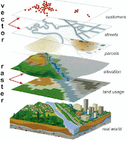
A geographic information system (GIS) allows for the display of database information on a visual map. A GIS does not contain any maps or graphics, it creates maps and graphics from the information contained in the databases. GIS is not a mapping program, it is a complex mix of database management, display technology, and analysis tools that can be used to create maps. All the information in a GIS is referenced to a location. A GIS can contain images of aerial photography, photographs of homes, and floor plans of buildings, and large amounts of text and attribute information, but they are all tied into the databases by their location on the earth's surface.
